


 On eBay Now...
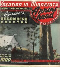
Vintage 1940 Road Map Brochure MINNESOTA ARROWHEAD COUNTRY Canoe Routes Duluth For Sale

When you click on links to various merchants on this site and make a purchase, this can result in this site earning a commission. Affiliate programs and affiliations include, but are not limited to, the eBay Partner Network.

Vintage 1940 Road Map Brochure MINNESOTA ARROWHEAD COUNTRY Canoe Routes Duluth:
$129.99
Handsome large-format fold-out 1940 road map of Minnesota's Arrowheadregion,printed more than 80 years ago.
- This map opens to 24" x 36"and shows railroads, automobile roads, canoe routes, Indianreservations,counties, cities, and towns.
- It has photographs of local tourist attractions,wildlife, NativeAmericans, and iron ore mining operations.
- It was published by the Minnesota Arrowhead Associationand iscopyrighted © 1940. It is titled Mapof the MinnesotaArrowhead Country and Adjacent Canadian Cities in the Greater Arrowhead.
- On the reverse side there are travel directions, descriptions of locallandmarks and recreational facilities, and ads for hotels and resorts.
- Condition: It is in very good condition,bright and clean, with no rips, tears, or writing.It folds to 9" x 4". The paper has stiffened slightly, and you willwant tohandle it carefully, as you would any old document. Please see thescans and feel free to ask any questions.
- The Arrowhead region of northeastern Minnesota starts atDuluth and stretches north to the Canadian border and west to Bemidji,includingBrainerd, Grand Rapids, Superior National Forest, Hibbing, Aitkin, Fonddu LacIndian Reservation, Vermilion Lake, Itasca, Cloquet, and the Gunflint Trail.
- Buy with confidence! We arealways happy to combineshipping on the purchase of multiple items — just make sure to pay foreverythingat one time, not by SixBit's eCommerce Solution
Related Items:
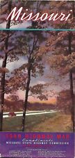
Vintage 1940 Official State Highway Road Map MISSOURI Route 66 Ste. Genevieve
$24.99
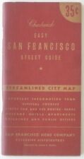
Vintage 1940 Chadwick Street Directory & Map SAN FRANCISCO Cable Car Trolley Bus
$19.99
Vintage 1940 Road Map Brochure MINNESOTA ARROWHEAD COUNTRY Canoe Routes Duluth
$129.99