


 On eBay Now...
Vintage 1939 ESSO Road Map WEST VIRGINIA MARYLAND DELAWARE Richmond Cape Charles For Sale

When you click on links to various merchants on this site and make a purchase, this can result in this site earning a commission. Affiliate programs and affiliations include, but are not limited to, the eBay Partner Network.

Vintage 1939 ESSO Road Map WEST VIRGINIA MARYLAND DELAWARE Richmond Cape Charles:
$14.99
HandsomeEsso fold-out 1939 Esso road map of Virginia, West Virginia, Maryland,and Delaware, printed more than 78 years ago.
- This map opens to 22" x 32"and has greatdetail on old highway alignments, with cartography by the the reverse side there's a pictorial guide and insetplans of Baltimore, Wilmington, Norfolk, Richmond, Shenandoah NationalPark, and Washington, D.C.
- This map was published by the Standard Oil Company of NewJersey in1939 and is dated on the cover and in the legend.
- The photo on the front shows the Capitol building atWilliamsburg,Colonial National Historical Park.
- Condition: This map is in very good, lightly usedcondition,with short breaks on two fold corners. There's a route marked throughShenandoah National Park,Richmond, and the Delmarva Peninsula, via the Cape Charles Ferry.Please see the scans and feel free to ask any questions.
- Buy with confidence! We are always happy to combineshipping on the purchase of multiple items — just make sure to pay foreverythingat one time, not by SixBit's eCommerce Solution
Related Items:
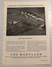
Vintage 1939 The Maryland Insurance Print Ad - Full Page - One More Redskin
$16.00
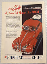
Vintage 1939 Pontiac Eight Print Ad - Full Page - It’s A Great Performer
$16.00
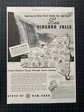
Vintage 1939 New York State Travel, Niagara Falls Print Ad
$28.60